29 May 2017
Marais Poitevin: France’s Green Venice
Probably the best known and certainly the largest wetlands in France is the Camargue. Yet the second largest is, outside of the country, little known. Marais Poitevin in the south western region of Poitou-Charentes covers a huge area – over 370 square miles. Its name means the Poitou Marsh but the French also know it by a more venerable title - la Venise Verte. This Green Venice certainly lives up to its name.
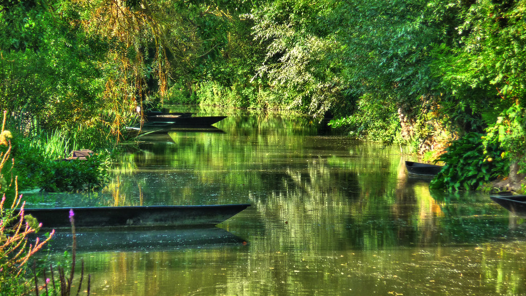
A maze of islets intersected by strikingly attractive canals covers a third of the marais, known as the wet marsh. Duckweed often covers the surface of the water which is how the place got its sobriquet. The place oozes peace. If you want tranquility, here you have it. Yet it was not always so.
Image Credit Flickr User Mickael T
Image Credit Flickr User Alain Joseph
Many paths were cleared across the land during the Roman period and it was settled by the Picton tribe who also gave their name to the nearby city of Poitiers. Later centuries would see raids by the Vikings, which forced the local population deeper in to the wildest areas of the marsh where they subsisted, living the life of hunter-gatherers in to medieval times. Yet almost each year their huts would be flooded by rising waters.
Image Credit Flickr User Webzooloo
Image Credit Wikimedia
The drainage proper of the marsh started around the eleventh century when Benedictine monks saw the place as both a place to build abbeys, raise crops and, because of its isolation, keep the rest of the world at least partly at bay. The monks built three canals, the Bot-Neuf (1199), The Bot de Vendée (1210), and finally the largest canal des Cinq Abbés (1217), which is over 11 km long.
Image Credit Flickr User Olivier Levy
Image Credit Flickr User Frank44
Their work was later carried on by Dutch workmen who built a series of drogues (dykes) which successfully kept the sea at bay. Yet despite all of this work the area was still waterlogged and even the villages which sprang up inside the marsh had ports which endured until the nineteenth century. Travel by boat was the only means to traverse the marsh and even markets were held on the waterways.
Image Credit Flickr User Charente Maritime Tourisme
Image Credit Flickr User Alain Joseph
The dykes sheltered the land from the sea; the canals protected it from the flood water of local rivers during the winter and spring by giving it a pathway towards the ocean. Yet the various religious wars of the fourteenth and fifteenth centuries saw all this work come to virtually nothing. The marais reverted back, almost to its original state, due to a combination of lack of upkeep and deliberate destruction. The latter was due to the Dutch habit of seizing half the land if the owners refused to build dykes (this was done with the permission of the king). The owners, naturally, were having none of it.
Image Credit Flickr User nigelphoto2011
The Dutch and their money progressively departed but the project of draining the land continued thanks to the efforts of the now financially recovered local landowners and lords. Villages continued to spring up and common land was established. By the end of the seventeenth century the marsh was split in two areas, the dry and the wet with the former completely reclaimed from the sea. The remaining wet area became notorious as a hiding place for local thieves and murderers, where the law of the land meant little.
Image Credit Flickr User Bruno Pajaud
Yet within a hundred years the wetland and its people was as wealthy as those who settled on the dry marsh. The 1800s saw a renewal of work on the wet marsh and the canals we can see today were constructed. The reed beds of the area gradually gave way to the farmland used to this day. Although the area was made a Regional Natural Park in 1979 it lost that status twenty years later as intensive farming continued to damage the unique character of the marsh. Attempts are still being made to regain the title but to no avail as yet.
Image Credit Flickr User Platanax
Image Credit Flickr User Alain Joseph
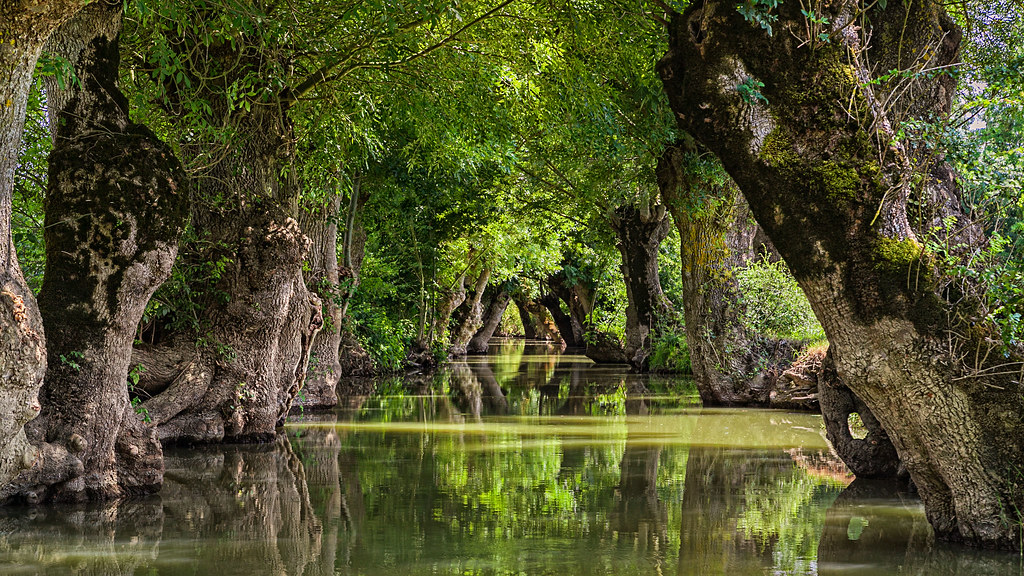
Yet the marsh remains captivatingly beautiful. Willows and poplar trees line its banks, their roots supporting the structure of the canals. They are typically planted in rows along with ash. They are regularly pollarded and their roots are pivotal in holding the earth of the banks together and offer the visitor an exquisite and unusual landscape. No wonder the sign in one of the local villages, Coulon, reads Ralentissez et Admirez – you have to do exactly what it says here: slow down and admire.
First Image Credit Flickr User Charente Maritime Tourisme
A maze of islets intersected by strikingly attractive canals covers a third of the marais, known as the wet marsh. Duckweed often covers the surface of the water which is how the place got its sobriquet. The place oozes peace. If you want tranquility, here you have it. Yet it was not always so.
Image Credit Flickr User Mickael T
Image Credit Flickr User Alain Joseph
Many paths were cleared across the land during the Roman period and it was settled by the Picton tribe who also gave their name to the nearby city of Poitiers. Later centuries would see raids by the Vikings, which forced the local population deeper in to the wildest areas of the marsh where they subsisted, living the life of hunter-gatherers in to medieval times. Yet almost each year their huts would be flooded by rising waters.
Image Credit Flickr User Webzooloo
Image Credit Wikimedia
The drainage proper of the marsh started around the eleventh century when Benedictine monks saw the place as both a place to build abbeys, raise crops and, because of its isolation, keep the rest of the world at least partly at bay. The monks built three canals, the Bot-Neuf (1199), The Bot de Vendée (1210), and finally the largest canal des Cinq Abbés (1217), which is over 11 km long.
Image Credit Flickr User Olivier Levy
Image Credit Flickr User Frank44
Their work was later carried on by Dutch workmen who built a series of drogues (dykes) which successfully kept the sea at bay. Yet despite all of this work the area was still waterlogged and even the villages which sprang up inside the marsh had ports which endured until the nineteenth century. Travel by boat was the only means to traverse the marsh and even markets were held on the waterways.
Image Credit Flickr User Charente Maritime Tourisme
Image Credit Flickr User Alain Joseph
The dykes sheltered the land from the sea; the canals protected it from the flood water of local rivers during the winter and spring by giving it a pathway towards the ocean. Yet the various religious wars of the fourteenth and fifteenth centuries saw all this work come to virtually nothing. The marais reverted back, almost to its original state, due to a combination of lack of upkeep and deliberate destruction. The latter was due to the Dutch habit of seizing half the land if the owners refused to build dykes (this was done with the permission of the king). The owners, naturally, were having none of it.
Image Credit Flickr User nigelphoto2011
The Dutch and their money progressively departed but the project of draining the land continued thanks to the efforts of the now financially recovered local landowners and lords. Villages continued to spring up and common land was established. By the end of the seventeenth century the marsh was split in two areas, the dry and the wet with the former completely reclaimed from the sea. The remaining wet area became notorious as a hiding place for local thieves and murderers, where the law of the land meant little.
Image Credit Flickr User Bruno Pajaud
Image Credit Flickr User Platanax
Image Credit Flickr User Alain Joseph
Yet the marsh remains captivatingly beautiful. Willows and poplar trees line its banks, their roots supporting the structure of the canals. They are typically planted in rows along with ash. They are regularly pollarded and their roots are pivotal in holding the earth of the banks together and offer the visitor an exquisite and unusual landscape. No wonder the sign in one of the local villages, Coulon, reads Ralentissez et Admirez – you have to do exactly what it says here: slow down and admire.
First Image Credit Flickr User Charente Maritime Tourisme


